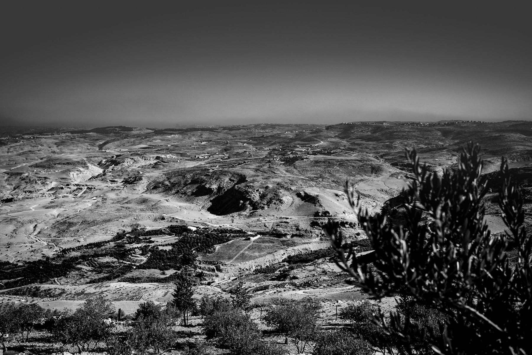
The stark contrast of black and white photography often reveals the raw texture of a landscape, stripping away the distractions of color to expose the underlying geography and history. The featured image captures a vast, undulating terrain characteristic of the southern Levant—a region encompassing modern-day Jordan, Israel, Palestine, and the wider West Bank. This rugged topography is not merely a natural formation; it is a historical document written in stone, soil, and ancient pathways.
A Visual Analysis of the Arid Highlands
In the foreground of the photograph, the soft focus of olive branches frames a panoramic view of deep valleys and dry ridges. The landscape is characterized by sparse vegetation, rocky outcrops, and winding dirt tracks that trace the contours of the hills.
In the mid-ground, distinct patterns of agricultural terracing are visible on the slopes. These terraces, along with clustered settlements visible on the distant ridges, indicate a long-standing human presence adapted to a challenging, semi-arid environment. The play of light and shadow emphasizes the deep ravines and the erosion patterns that have shaped this plateau over millennia.
The Historical Crossroads of Civilizations
The region depicted in the image has served as one of the most significant geographical corridors in human history. Situated at the crossroads of Africa, Asia, and Europe, these hills have witnessed the passage of nomadic tribes, merchants, and conquering empires for thousands of years.
– Ancient Trade Routes: This terrain was traversed by major historical trade routes, including the ancient King’s Highway. This route facilitated the trade of valuable commodities such as frankincense, myrrh, and spices between Southern Arabia and the Mediterranean world. – Imperial Footprints: From the Egyptians and Canaanites to the Romans, Byzantines, and Ottomans, successive empires have sought control over these highlands. The winding paths visible in the landscape often follow the alignments of ancient Roman roads, which were constructed to secure military dominance and facilitate administrative control over the province of Judaea and Arabia Petraea.
The Legacy of Ancient Agriculture and Olive Cultivation
The presence of olive trees in the foreground and the terraced hillsides in the distance highlight the agricultural history of the Levant. Terracing is an ancient engineering technique developed during the Bronze Age to prevent soil erosion and conserve scarce rainwater on steep slopes.
The olive tree (Olea europaea) has been cultivated in this region for over 6,000 years. It holds immense historical, economic, and cultural significance. In antiquity, olive oil was not only a dietary staple but also a primary source of fuel for lighting, a base for cosmetics, and a key export commodity that fueled the economies of ancient Mediterranean civilizations.
A Timeless Topography
Today, this landscape remains a powerful symbol of endurance. While modern infrastructure and settlements continue to expand along the ridges, the fundamental character of the terrain remains unchanged. The photograph captures the enduring relationship between humanity and a demanding environment, where every ridge and valley holds a layer of historical significance.
Schreibe einen Kommentar