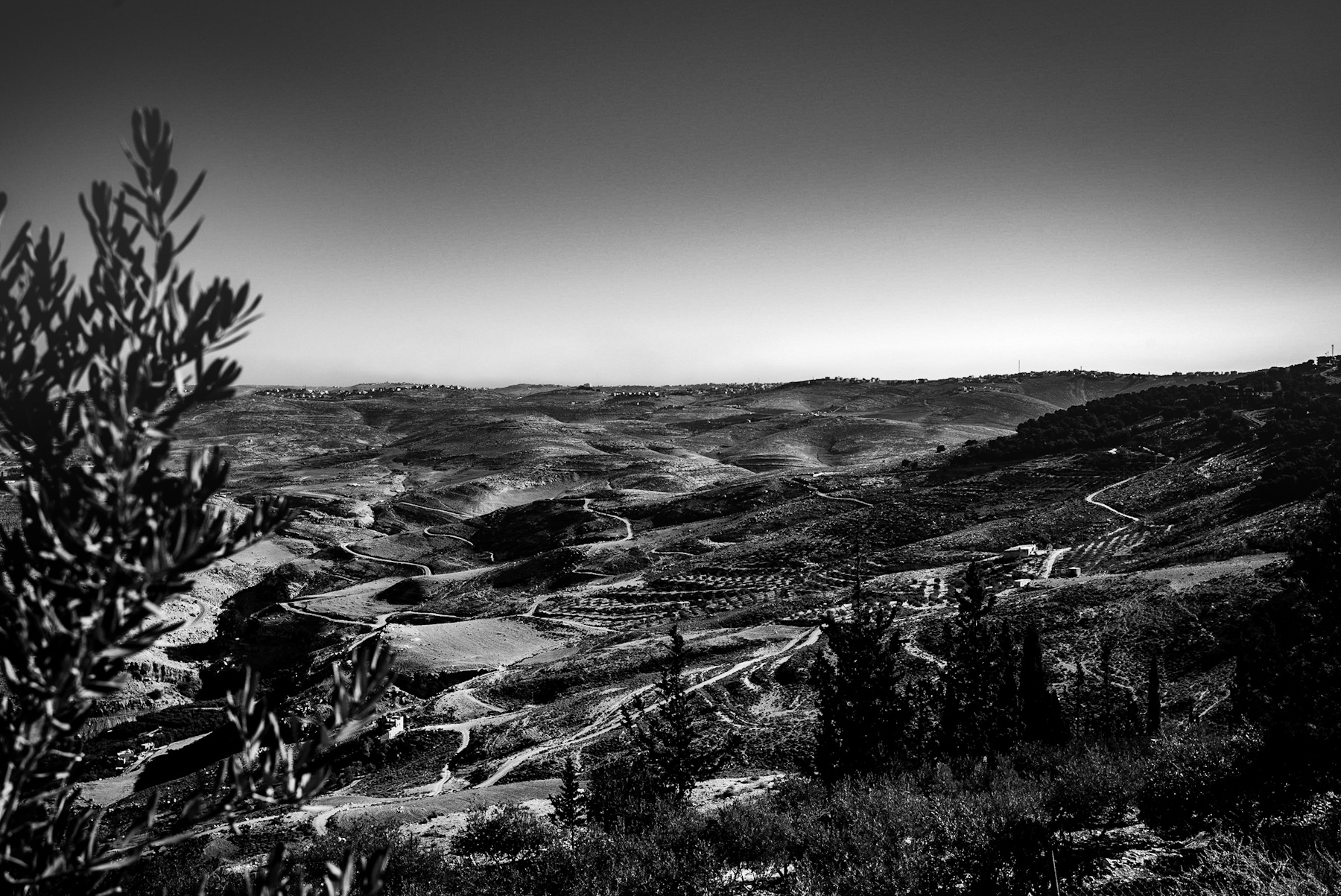
The monochrome photograph captures a vast, undulating landscape defined by rolling hills, winding paths, and sparse vegetation. In the foreground, the soft focus of an olive branch frames the scene, leading the viewer’s eye across the terraced slopes. Narrow, serpentine roads carve through the rugged terrain, tracing the contours of the land. In the far distance, small settlements dot the ridgeline under a clear, expansive sky. This stark, high-contrast imagery highlights the timeless and enduring nature of the Levant region, offering a visual narrative that bridges the gap between ancient history and the modern era.
The Geography of the Judean Wilderness
The terrain depicted in the image is highly characteristic of the Judean Hills and the transition zone leading toward the Judean Desert. Located in the southern Levant, this region features limestone hills that have been shaped by centuries of natural erosion and human activity.
The stark contrast of the black and white medium emphasizes the geological formations, showcasing the ridges and valleys that have served as both natural barriers and vital pathways for millennia. The winding tracks visible in the image are modern iterations of ancient routes. For thousands of years, these paths connected historic cities such as Jerusalem, Bethlehem, and Hebron, serving as essential corridors for trade, pilgrimage, and military campaigns.
Agricultural Heritage and Terraced Farming
A key feature of this landscape is the presence of agricultural terraces, visible along the hillsides. For thousands of years, inhabitants of this region have carved these stone-walled terraces into the steep slopes. This traditional farming method was essential for preventing soil erosion during the winter rains and conserving scarce water resources in an otherwise arid environment.
The olive branch in the foreground of the photograph serves as a direct reference to this agricultural heritage. Olive cultivation in the Levant dates back to the Chalcolithic period (circa 4000 BCE), making it one of the oldest managed agricultural practices in human history. Olive oil was not only a dietary staple but also a valuable commodity for trade, temple rituals, and lighting in the ancient Mediterranean world.
A Crossroads of Civilizations
Beyond its physical geography, this landscape carries profound historical and cultural weight. As a land bridge between Africa, Asia, and Europe, the Judean Hills have witnessed the rise and fall of numerous empires. From the Canaanites and Israelites to the Romans, Byzantines, Crusaders, and Ottomans, each civilization has left its mark on this terrain.
The enduring layout of the land, preserved in the photograph’s timeless presentation, reflects how the physical environment shaped the strategic movements, defense, and spiritual practices of ancient peoples. The hills provided refuge for hermits and rebels alike, while the high ridges served as strategic watchpoints.
Conclusion
Through the lens of monochrome photography, the contemporary details of the landscape fade, leaving a scene that could easily belong to antiquity. The image serves as a visual testament to human adaptation and resilience, illustrating how the historical geography of the Judean Hills continues to define the region’s identity today.
The Geography of the Judean Wilderness
The terrain depicted in the image is highly characteristic of the Judean Hills and the transition zone leading toward the Judean Desert. Located in the southern Levant, this region features limestone hills that have been shaped by centuries of natural erosion and human activity.
The stark contrast of the black and white medium emphasizes the geological formations, showcasing the ridges and valleys that have served as both natural barriers and vital pathways for millennia. The winding tracks visible in the image are modern iterations of ancient routes. For thousands of years, these paths connected historic cities such as Jerusalem, Bethlehem, and Hebron, serving as essential corridors for trade, pilgrimage, and military campaigns.
Agricultural Heritage and Terraced Farming
A key feature of this landscape is the presence of agricultural terraces, visible along the hillsides. For thousands of years, inhabitants of this region have carved these stone-walled terraces into the steep slopes. This traditional farming method was essential for preventing soil erosion during the winter rains and conserving scarce water resources in an otherwise arid environment.
The olive branch in the foreground of the photograph serves as a direct reference to this agricultural heritage. Olive cultivation in the Levant dates back to the Chalcolithic period (circa 4000 BCE), making it one of the oldest managed agricultural practices in human history. Olive oil was not only a dietary staple but also a valuable commodity for trade, temple rituals, and lighting in the ancient Mediterranean world.
A Crossroads of Civilizations
Beyond its physical geography, this landscape carries profound historical and cultural weight. As a land bridge between Africa, Asia, and Europe, the Judean Hills have witnessed the rise and fall of numerous empires. From the Canaanites and Israelites to the Romans, Byzantines, Crusaders, and Ottomans, each civilization has left its mark on this terrain.
The enduring layout of the land, preserved in the photograph’s timeless presentation, reflects how the physical environment shaped the strategic movements, defense, and spiritual practices of ancient peoples. The hills provided refuge for hermits and rebels alike, while the high ridges served as strategic watchpoints.
Conclusion
Through the lens of monochrome photography, the contemporary details of the landscape fade, leaving a scene that could easily belong to antiquity. The image serves as a visual testament to human adaptation and resilience, illustrating how the historical geography of the Judean Hills continues to define the region’s identity today.
Schreibe einen Kommentar