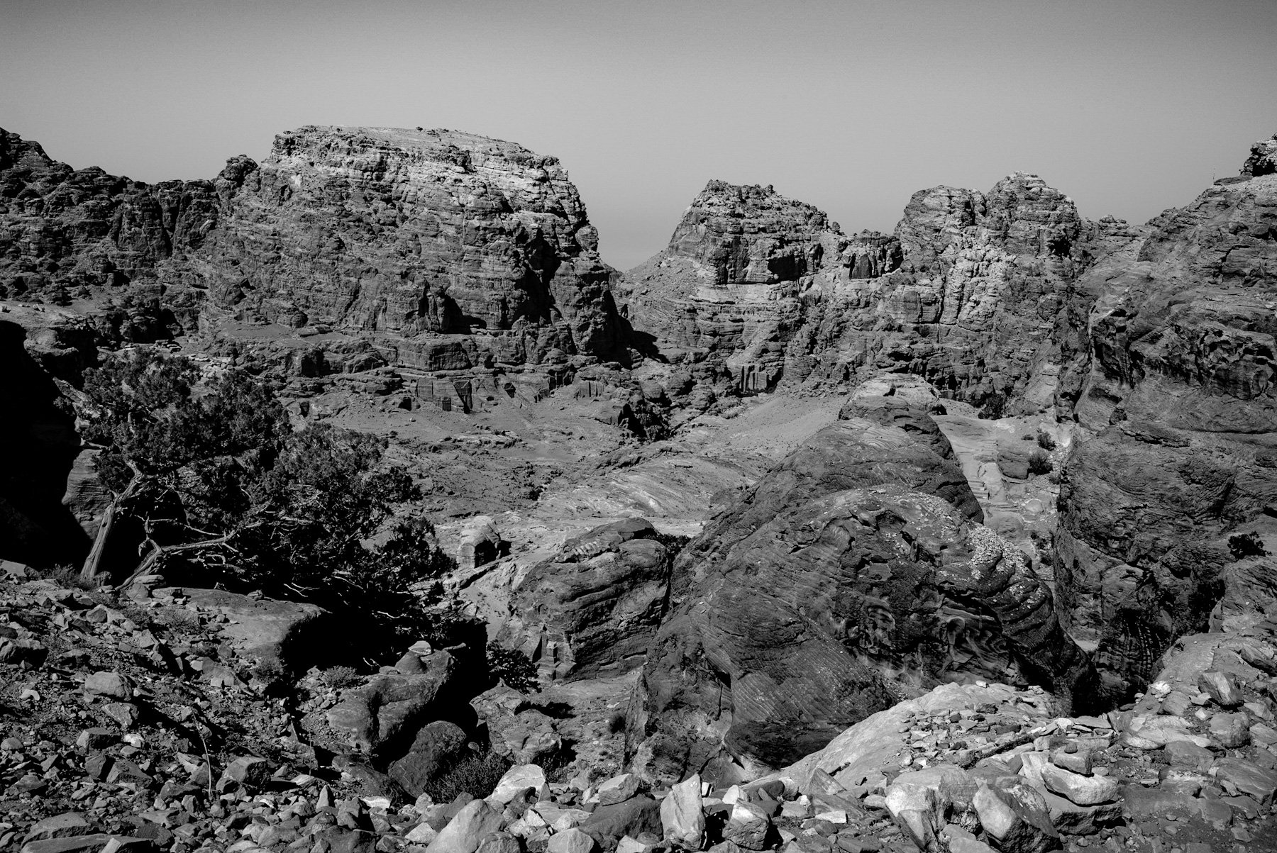
The presented black-and-white photograph captures a dramatic vista of a rugged, mountainous terrain. In the foreground, rough, weathered stones and sparse, hardy vegetation frame a deep valley. The midground and background reveal massive sandstone cliffs, within which the distinct outlines of monumental, rock-cut facades are visible. This dramatic landscape is none other than the ancient archaeological site of Petra, located in modern-day Jordan. By utilizing a monochrome format, the image strips away the famous „rose-red“ color of the rocks, focusing the viewer’s attention instead on the stark geological textures, the play of light and shadow, and the sheer scale of human ambition carved into nature.
The Visual Composition: Nature Meets Human Ingenuity
The photograph illustrates the challenging environment of the region. The foreground is dominated by fractured rocks and a resilient desert shrub, showcasing the arid conditions of the Jordanian desert. Beyond this rugged descent, the valley floor rises into towering cliffs.
Cut directly into these sheer rock faces are ancient structures. Even in the grayscale image, the precise, geometric lines of Nabataean architecture stand out against the organic, eroded surfaces of the mountains. These carvings represent tombs, temples, and dwellings, illustrating a unique relationship between the natural topography and monumental architecture.
Historical Context: The Rise of the Nabataean Kingdom
To fully appreciate this landscape, one must look back over two millennia. Petra was the flourishing capital of the Nabataean Kingdom, established as early as the 4th century BCE. The Nabataeans were originally nomadic Arabs who strategically settled in this mountainous stronghold.
By mastering the harsh desert environment, they seized control of vital regional trade routes. Petra became a major caravan hub, linking the silk and spice routes of China and India with the markets of Greece, Rome, and Egypt. The immense wealth generated from tolls and the trade of frankincense and myrrh funded the construction of the monumental city visible in the cliffs today.
Architectural and Engineering Marvels
The structures carved into the rock faces, visible in the background of the image, are renowned for their architectural fusion. Nabataean builders blended Hellenistic, Roman, Egyptian, and Mesopotamian styles into a unique aesthetic. Rather than constructing with quarried stone, they carved directly into the living sandstone cliffs from the top down, a technique requiring immense precision.
Beyond their aesthetic achievements, survival in this hyper-arid landscape required advanced engineering. The Nabataeans developed highly sophisticated water-management systems. They constructed dams, cisterns, and ceramic pipelines to harvest rainwater and control flash floods. This infrastructure transformed the dry canyons into a thriving oasis capable of supporting a population of up to 30,000 residents.
Decline and Modern Significance
Petra’s prominence began to decline after its annexation by the Roman Empire in 106 CE. As maritime trade routes became more popular and devastating earthquakes damaged the city’s infrastructure in the 4th and 6th centuries, the city was eventually abandoned.
For centuries, the site remained known only to the local Bedouin tribes. It was reintroduced to the global public in 1812 by the Swiss explorer Johann Ludwig Burckhardt. Today, Petra is recognized as a UNESCO World Heritage Site and stands as one of the New Seven Wonders of the World, attracting visitors globally who come to witness this historic intersection of nature, culture, and ancient engineering.
The Visual Composition: Nature Meets Human Ingenuity
The photograph illustrates the challenging environment of the region. The foreground is dominated by fractured rocks and a resilient desert shrub, showcasing the arid conditions of the Jordanian desert. Beyond this rugged descent, the valley floor rises into towering cliffs.
Cut directly into these sheer rock faces are ancient structures. Even in the grayscale image, the precise, geometric lines of Nabataean architecture stand out against the organic, eroded surfaces of the mountains. These carvings represent tombs, temples, and dwellings, illustrating a unique relationship between the natural topography and monumental architecture.
Historical Context: The Rise of the Nabataean Kingdom
To fully appreciate this landscape, one must look back over two millennia. Petra was the flourishing capital of the Nabataean Kingdom, established as early as the 4th century BCE. The Nabataeans were originally nomadic Arabs who strategically settled in this mountainous stronghold.
By mastering the harsh desert environment, they seized control of vital regional trade routes. Petra became a major caravan hub, linking the silk and spice routes of China and India with the markets of Greece, Rome, and Egypt. The immense wealth generated from tolls and the trade of frankincense and myrrh funded the construction of the monumental city visible in the cliffs today.
Architectural and Engineering Marvels
The structures carved into the rock faces, visible in the background of the image, are renowned for their architectural fusion. Nabataean builders blended Hellenistic, Roman, Egyptian, and Mesopotamian styles into a unique aesthetic. Rather than constructing with quarried stone, they carved directly into the living sandstone cliffs from the top down, a technique requiring immense precision.
Beyond their aesthetic achievements, survival in this hyper-arid landscape required advanced engineering. The Nabataeans developed highly sophisticated water-management systems. They constructed dams, cisterns, and ceramic pipelines to harvest rainwater and control flash floods. This infrastructure transformed the dry canyons into a thriving oasis capable of supporting a population of up to 30,000 residents.
Decline and Modern Significance
Petra’s prominence began to decline after its annexation by the Roman Empire in 106 CE. As maritime trade routes became more popular and devastating earthquakes damaged the city’s infrastructure in the 4th and 6th centuries, the city was eventually abandoned.
For centuries, the site remained known only to the local Bedouin tribes. It was reintroduced to the global public in 1812 by the Swiss explorer Johann Ludwig Burckhardt. Today, Petra is recognized as a UNESCO World Heritage Site and stands as one of the New Seven Wonders of the World, attracting visitors globally who come to witness this historic intersection of nature, culture, and ancient engineering.
Schreibe einen Kommentar