• Echoes of the Nabataeans: Jordan’s Ancient Sandstone Secrets

    Echoes of the Nabataeans: Jordan’s Ancient Sandstone Secrets

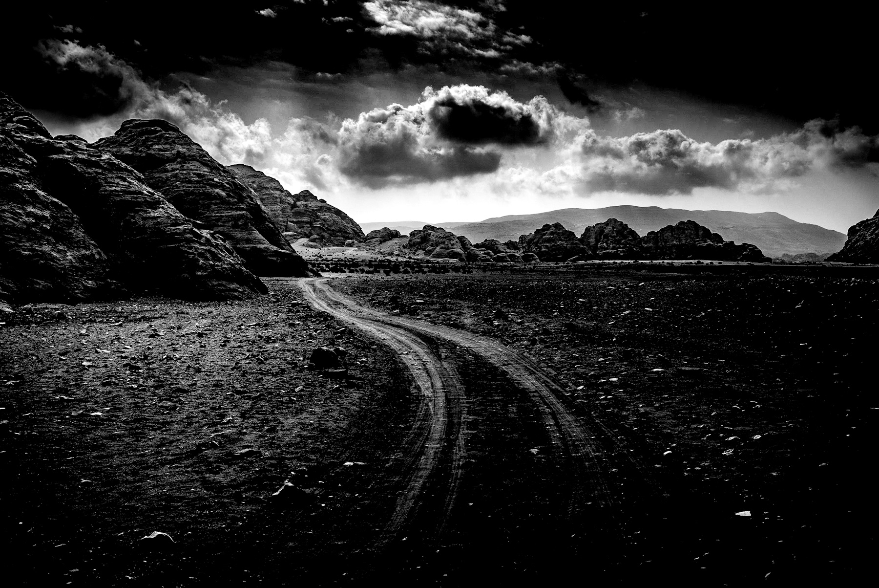
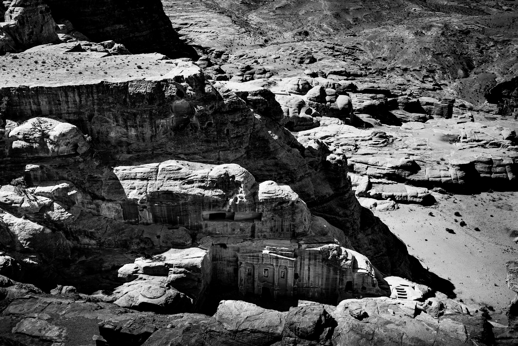
    The stark contrast of black and white photography brings a timeless quality to the rugged landscapes of southern Jordan. The image captures a barren, gravel-strewn valley bordered by massive, weathered sandstone formations. A winding dirt track snakes through the center, leading the eye toward towering rock faces characterized by deep vertical fissures and rounded, beehive-like shapes. The harsh sunlight casts deep shadows, emphasizing the texture of the arid terrain and the ancient geological structures that define this historic region.
    Ancient Formations, Enduring Legacy
    The rock formations depicted are typical of the area surrounding Petra and Little Petra (Siq al-Barid). Composed primarily of Cambrian and Ordovician sandstone, these magnificent cliffs have been shaped over millions of years by relentless wind and water erosion. Historically, this challenging yet breathtaking terrain was the heartland of the Nabataean Kingdom, an ancient Arab civilization that flourished from the 4th century BCE until its annexation by the Roman Empire in 106 CE. The Nabataeans recognized the strategic value of these natural sandstone barriers, choosing not merely to build upon the land but to carve their monumental tombs, temples, and dwellings directly into the cliff faces, creating a unique synthesis of nature and architecture that still astounds visitors today.
    Masters of Trade and Water
    The winding path visible in the image is a powerful echo of the ancient caravan routes that once traversed this very region. The Nabataeans amassed immense wealth by ingeniously controlling the vital trade routes of the ancient world. They were at the heart of networks like the Incense Route, which connected the Arabian Peninsula with crucial Mediterranean ports. Caravans laden with valuable commodities such as frankincense, myrrh, exotic spices, and precious silk journeyed through these narrow valleys. To not only survive but thrive in this hyper-arid environment, the Nabataeans developed highly sophisticated water harvesting and storage systems. These innovations allowed them to support a large population and offer much-needed refuge to weary travelers, cementing their position as a crucial hub. The defensive advantages offered by this landscape were unparalleled. The deep canyons, famously known as siqs, provided natural protection against invading forces, rendering the Nabataean capital of Petra virtually impregnable for centuries.
    A Timeless Connection to the Desert Landscape
    Today, this extraordinary region is globally recognized for its profound cultural and historical value. Petra, the crown jewel, was deservedly designated a UNESCO World Heritage Site in 1985, drawing archaeologists, historians, and eager travelers from every corner of the globe. The photograph serves as a poignant visual reminder of the enduring and intricate relationship between human civilization and the natural environment. While the ancient traders and skilled builders have long departed, the majestic sandstone cliffs and the very desert pathways remain, meticulously preserving the history of a culture that mastered one of the most inhospitable landscapes on Earth. For modern visitors, exploring these ancient paths offers a profound and tangible connection to the past, where every weathered rock formation whispers a story of survival, ingenious engineering, and unparalleled architectural brilliance.
  • Echoes of the Nabataeans: Where Ancient History Meets Daily Life in Petra

    Echoes of the Nabataeans: Where Ancient History Meets Daily Life in Petra

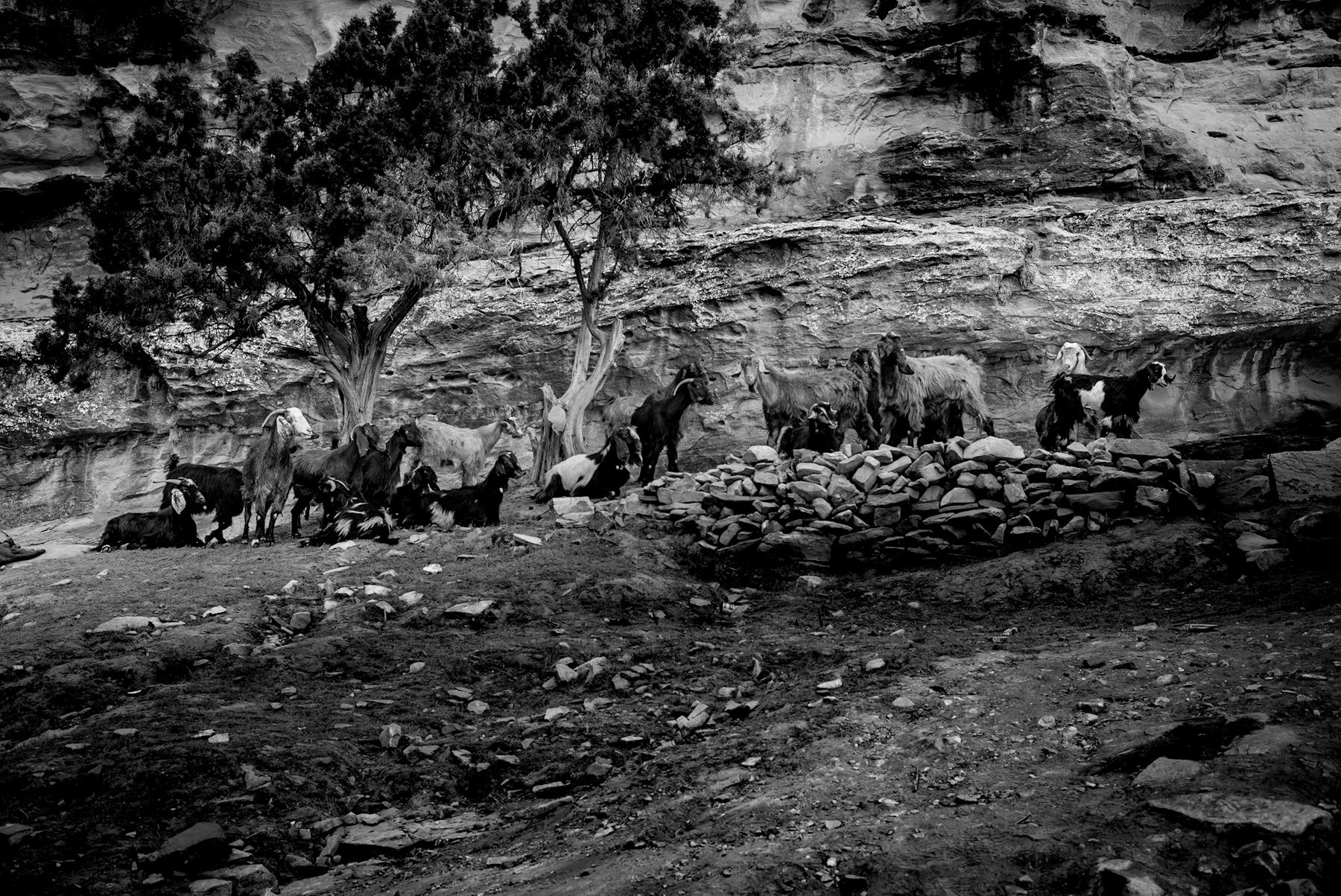
    The stark contrast of black-and-white photography often reveals the raw essence of a landscape, stripping away the distraction of color to focus on form, texture, and history. In this striking image, the timeless ruggedness of Jordan’s desert landscape is captured in a single, powerful frame. The photograph depicts a herd of goats traversing a rocky plain, set against the monumental backdrop of ancient rock-cut architecture and dramatic, cloud-filled skies. This scene is not merely a depiction of rural life; it is a visual bridge connecting modern pastoral traditions with one of the ancient world’s most remarkable civilizations.
    A Landscape Carved by Time and Human Hands
    In the foreground of the image, a herd of goats moves systematically across a stony, arid terrain. This daily ritual of pastoralism has remained largely unchanged for millennia in the Middle East. However, it is the background that elevates this scene from a simple pastoral photograph to a historical document.
    The towering sandstone cliffs visible in the background are characteristic of the region surrounding Petra, the ancient capital of the Nabataean Kingdom. Carved directly into the sheer rock faces are the dark openings of ancient caves and tombs. High on the ridge to the right, a monumental structure stands silhouetted against the dark, dramatic clouds. This architectural style, blending Hellenistic design elements with traditional Eastern motifs, is the hallmark of Nabataean craftsmanship.
    The Historical Legacy of the Nabataean Kingdom
    To understand the significance of the structures carved into these cliffs, one must look back to the Nabataeans, a nomadic Arab people who settled in the southern Levant around the 4th century BCE. Petra, strategically located at the crossroads of ancient trade routes, became the prosperous capital of their empire.
    The Nabataeans accumulated immense wealth by controlling the trade of luxury goods, particularly frankincense, myrrh, and spices, which were transported from the Arabian Peninsula to the Mediterranean ports. This wealth allowed them to transform the rugged sandstone canyons into a thriving metropolis.
    The carvings shown in the photograph are remnants of this golden age. While Petra is famous for grand monuments like the Treasury (Al-Khazneh) and the Monastery (Ad Deir), the surrounding valleys are filled with hundreds of smaller rock-cut tombs, dwellings, and cisterns. The Nabataeans were master hydrologists, constructing complex systems of dams, conduits, and reservoirs that allowed them to survive and flourish in an otherwise inhospitable desert environment.
    The Continuity of Bedouin Culture
    The presence of the goat herd in the photograph highlights the cultural continuity of the region. Following the decline of the Nabataean Empire and the subsequent Roman and Byzantine eras, Petra was largely forgotten by the Western world until its rediscovery in 1812. Throughout these centuries, local Bedouin tribes, such as the Bdoul, inhabited the ancient caves and maintained their traditional pastoral lifestyle.
    Today, while Petra is recognized as a UNESCO World Heritage Site and a major global tourist destination, the traditional herding of livestock remains an integral part of the local economy and cultural identity. The image captures this harmonious coexistence: the monumental, permanent structures of a long-lost empire serving as the backdrop for the transient, daily patterns of nomadic life.
  • Echoes in the Stone: Exploring the Historical Depth of Arid Desert Landscapes

    Echoes in the Stone: Exploring the Historical Depth of Arid Desert Landscapes

    Arid landscapes have long captured the human imagination. Across the globe, rocky deserts and dry valleys serve as stark reminders of nature’s raw power and the passage of time. The monochrome photograph presented here captures a rugged, boulder-strewn valley, likely a wadi, winding through eroded mountain ranges. This specific topography is characteristic of Middle Eastern desert regions, such as the Sinai Peninsula, the Negev, or the mountainous areas of Jordan.
    By stripping away color, the high-contrast black-and-white image emphasizes the harsh textures, unique geological formations, and sparse vegetation that define these ancient terrains.
    ***
    **Visual Analysis of the Desert Terrain**
    The photograph illustrates a classic desert valley floor, cluttered with a mixture of dark, basaltic boulders and lighter, weathered limestone rocks. In the foreground, the accumulation of stones indicates the path of a dry riverbed, or wadi. These channels remain dry for most of the year but can transform into raging torrents during brief, seasonal flash floods.
    Sparse, hardy vegetation, including deep-rooted shrubs and small acacia-like trees, clings to the rocky slopes. In the background, layered, sun-bleached mountains rise against a dark, cloudless sky. The lack of modern infrastructure highlights the isolation and timelessness of the environment, making it difficult to distinguish whether the image was captured today or a century ago.
    ***
    **The Historical Significance of the Wadi and Desert Routes**
    Regions matching this geological profile have played pivotal roles in human history. Far from being empty voids, these arid valleys served as crucial corridors for migration, trade, and cultural exchange for millennia.
    **1. Ancient Trade and the Incense Route**
    For thousands of years, deserts like the Negev and the Arabian Peninsula were crisscrossed by complex trade networks. The most famous of these, the Incense Route, facilitated the transport of frankincense and myrrh from southern Arabia to the Mediterranean port of Gaza. Nabataean merchants mastered the art of survival in these harsh landscapes, establishing hidden water cisterns and fortified outposts along rocky valleys similar to the one pictured.
    **2. Nomadic Survival and Bedouin Culture**
    The survival of nomadic tribes, such as the Bedouins, is deeply tied to this landscape. For centuries, these communities navigated the rugged terrain, utilizing wadis for seasonal grazing and water collection. Their deep understanding of geology and botany allowed them to thrive in an environment that appeared uninhabitable to outsiders.
    **3. Spiritual and Biblical History**
    In historical and religious texts, the wilderness is often depicted as a place of testing, refuge, and revelation. The Sinai Peninsula, characterized by its jagged granite mountains and deep valleys, is historically associated with the biblical Exodus. For early Christian monastics in the 3rd and 4th centuries, the extreme isolation of these desert valleys provided the perfect environment for spiritual contemplation, leading to the establishment of some of the world’s oldest continuously inhabited monasteries.
    ***
    **Conclusion**
    The rugged beauty captured in this black-and-white photograph is more than just a geological study; it is a visual record of a landscape that has profoundly shaped human civilization. From ancient traders navigating rocky paths to seekers of spiritual solitude, these timeless desert valleys remain a powerful symbol of endurance, history, and natural majesty.
  • Echoes of the Past: The Timeless Landscape and History of Jordan’s Desert

    Echoes of the Past: The Timeless Landscape and History of Jordan’s Desert

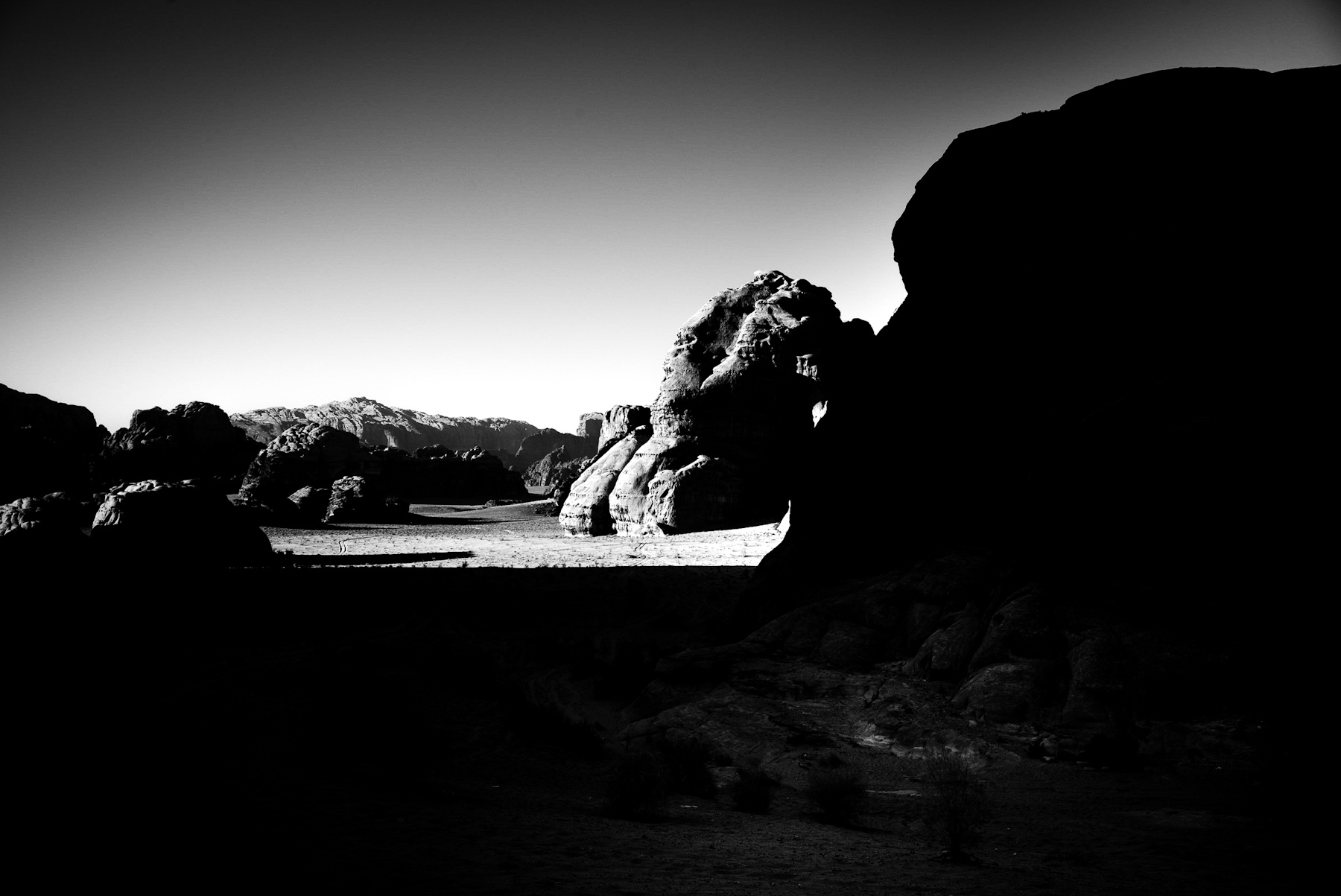
    This striking black and white photograph instantly transports you to a dramatic desert landscape, a realm of high contrast and geological grandeur. Deep shadows in the foreground cradle sparse desert vegetation, anchoring the scene with a strong tonal presence. Further back, the terrain unfolds into a sunlit, gravelly plain dotted with low-lying shrubs. To the right, a towering, sheer sandstone cliff dominates the frame, its vertical weathering and intricate geological layering a testament to ages past. In the distance, rugged, pyramid-like rock formations pierce a dark, cloudless sky, underscoring the profound isolation and vastness of this arid environment. This powerful visual composition strongly evokes the unique topography of southern Jordan, particularly the famed Wadi Rum valley, often revered as the Valley of the Moon.
    A Landscape Forged by Time: The Geological Foundation
    From a geological standpoint, the landscape captured in the image is a masterpiece forged over millions of years by unrelenting tectonic activity, fierce wind erosion, and persistent water carving. The massive sandstone and granite formations you see are characteristic features of the ancient Arabian Shield. The monochrome presentation of the photograph masterfully accentuates these textures, drawing out the subtle interplay between the soft sand, the resilient desert scrub, and the rigid, deeply weathered surfaces of the ancient cliffs. This visual dialogue creates an almost tangible sense of timelessness, presenting a landscape that has stood virtually unchanged for millennia.
    Whispers of Ancient Civilizations and Trade Routes
    Beyond its breathtaking natural beauty, landscapes like the one depicted here carry profound historical significance, echoing stories from forgotten ages. For thousands of years, these arid regions served as vital corridors, facilitating human migration, bustling trade, and vibrant cultural exchange.
    During classical antiquity, southern Jordan became the heartland of the Nabataeans, a remarkable nomadic Arab people who ingeniously forged a powerful trading empire. They didn’t just survive the harsh desert conditions; they mastered them, developing sophisticated water-harvesting systems that allowed them to control the immensely lucrative incense, spice, and silk trade routes connecting distant southern Arabia with the vibrant Mediterranean world. The massive sandstone cliffs, much like the one prominently featured on the right of the photo, frequently bear ancient petroglyphs and inscriptions in Thamudic, Nabataean, and early Arabic scripts. These intricate carvings are more than just art; they serve as a living historical archive, meticulously documenting the lives, beliefs, and languages of ancient travelers and nomads who once traversed these very paths.
    The Enduring Legacy of the Arab Revolt and Cultural Heritage
    In more recent history, this specific desert landscape gained global recognition through the pivotal events of the Arab Revolt (1916–1918). It was here that British officer T.E. Lawrence, globally immortalized as Lawrence of Arabia, traversed these expansive desert realms alongside Arab forces. The strategic geography of the rocky canyons and wide-open plains played an absolutely crucial role in the innovative guerrilla warfare tactics employed during the campaign against the Ottoman Empire.
    Today, this storied area remains the cherished home of the Bedouin people, who have diligently preserved their traditional knowledge of the desert ecosystem for generations. Recognized as a prestigious UNESCO World Heritage site, the region is celebrated not only for its unparalleled natural aesthetic but also for its remarkable cultural continuity. The silent, enduring rocks depicted in this photograph have witnessed the majestic rise and poignant fall of empires, the countless passages of ancient caravans laden with exotic goods, and the daily, resilient lives of desert nomads. They stand as an enduring monument to both human resilience and the vast tapestry of natural history.
  • Echoes of the Past: Exploring the Historical Landscape of Jordan’s Wadi Rum

    Echoes of the Past: Exploring the Historical Landscape of Jordan’s Wadi Rum

    The stark contrast of black-and-white photography often reveals the raw, unfiltered essence of a landscape. In this striking monochrome image, we are presented with a vast desert valley, characterized by towering, weathered rock formations, a sandy floor marked by vehicle tracks, and a solitary tree standing resiliently against the elements. This landscape is instantly recognizable as Wadi Rum, also known as the Valley of the Moon, located in southern Jordan.
    While the photograph captures a moment of quiet isolation, this region is steeped in thousands of years of human history, serving as a vital crossroads for ancient civilizations, traders, and historical figures.
    The Visual Narrative: Resilience in the Desert
    At first glance, the photograph highlights the dramatic geological features of Wadi Rum. The massive sandstone and granite cliffs rise abruptly from the desert floor, shaped by millions of years of wind and water erosion.
    In the lower-left quadrant, a single, leafy tree stands as a powerful symbol of life surviving in a hyper-arid environment. The presence of tire tracks winding through the sand introduces a modern element, indicating how contemporary travelers navigate this ancient terrain. The high-contrast black-and-white medium emphasizes the textures of the sand, the ruggedness of the rock faces, and the vast expanse of the sky, creating a timeless atmosphere.
    Ancient Crossroads: Nabataeans and Thamudic Tribes
    To understand the historical significance of the landscape in the photo, one must look back thousands of years. Wadi Rum has been inhabited since prehistoric times. Various cultures, including the Nabataeans—the master builders responsible for the ancient city of Petra—left their mark here.
    The valley served as a crucial route for merchant caravans transporting spices, incense, and valuable goods between the Arabian Peninsula and the Mediterranean. Throughout the canyons of Wadi Rum, thousands of rock inscriptions and petroglyphs can still be found. These inscriptions, written in Thamudic, Nabataean, and early Arabic scripts, document ancient journeys, religious practices, and the fauna that once roamed the region.
    The Era of Lawrence of Arabia and the Arab Revolt
    In modern history, the landscape of Wadi Rum is inextricably linked to the events of World War I and the Arab Revolt (1916–1918). British officer T.E. Lawrence, widely known as „Lawrence of Arabia,“ used the valley as a strategic base of operations.
    Along with Sharif Faisal Bin Al-Hussein, Lawrence coordinated guerrilla warfare tactics against the Ottoman forces from these very canyons. The rugged topography shown in the photograph provided natural fortifications and hiding places, making it a key tactical location during the conflict. Lawrence famously described the landscape of Wadi Rum in his autobiographical account, *Seven Pillars of Wisdom*, cementing the desert’s place in global literary and historical consciousness.
    A UNESCO World Heritage Site
    Today, the historical and ecological importance of this landscape is internationally recognized. In 2011, Wadi Rum was designated a UNESCO World Heritage Site. It is classified as a mixed natural and cultural site, acknowledging not only its spectacular desert landforms but also its 12,000 years of human occupation.
    The photograph captures the enduring spirit of this protected wilderness. While modern tourism brings visitors from around the world to trace the steps of ancient nomads and historical figures, the desert itself remains largely unchanged—a silent monument to the passage of time.
  • The Enduring Majesty of Petra’s Al-Deir: A Glimpse into Nabataean Grandeur

    The Enduring Majesty of Petra’s Al-Deir: A Glimpse into Nabataean Grandeur

    The monochromatic lens captures a profound sense of antiquity and drama, presenting Al-Deir, often known as The Monastery, as a monumental testament to ancient ingenuity. Carved directly into the formidable sandstone cliffs of Petra, Jordan, this iconic structure dominates the frame, its classical facade emerging with striking clarity from the rugged natural landscape. The use of black and white photography accentuates the intricate details of the rock-cut architecture, highlighting the interplay of light and shadow across its towering columns, elaborate pediment, and the weathered texture of the surrounding rock formations. In the foreground, sparse desert vegetation dots the sandy, rocky terrain, emphasizing the remote and challenging environment in which this architectural marvel was created. Overhead, dramatic clouds sweep across the sky, adding an ethereal depth and contributing to the timeless, almost otherworldly atmosphere of the scene.
    Petra: A Nabataean Legacy
    Al-Deir stands as a pinnacle of the Nabataean civilization, an ancient Arab people who flourished from the 4th century BCE to the 1st century CE. Petra, their capital city, was strategically located at the crossroads of major trade routes, connecting the Arabian Peninsula with Mesopotamia, Egypt, and the Mediterranean. The Nabataeans were master traders, engineers, and architects, renowned for their sophisticated water management systems that allowed them to thrive in the arid desert. Their wealth and cultural exchange fostered a unique artistic style, blending indigenous traditions with Hellenistic and Roman influences, evident in the intricate carvings that adorn their city. Petra’s hidden valleys and towering canyons provided natural defenses, making it a formidable stronghold and a bustling economic hub.
    Al-Deir: Architectural Grandeur and Purpose
    Al-Deir is one of Petra’s largest and most imposing monuments, often overshadowed by the more famous Treasury (Al-Khazneh) but equally significant. Its colossal dimensions—approximately 47 meters wide and 48 meters high—demonstrate an extraordinary feat of engineering and artistic vision, meticulously carved downwards from the top of the cliff. The facade features a grand portico with four massive columns, topped by a large urn, similar in style to the Treasury but with a more austere and monumental presence.
    While its exact original function remains a subject of scholarly debate, it is widely believed to have served as a temple, possibly dedicated to a deified Nabataean king or a major deity. The interior, though largely unadorned, features a vast chamber with a raised platform, suggesting its use for religious ceremonies or royal audiences. Its later use as a Christian monastery during the Byzantine era gave it its current name, with crosses etched into the walls. The arduous ascent to Al-Deir adds to its mystique, signifying its importance as a sacred or regal site.
    Enduring Significance
    Today, Al-Deir, along with the entire city of Petra, is recognized as a UNESCO World Heritage site and one of the New7Wonders of the World. The photograph eloquently captures the profound sense of history and human achievement embedded in its stone. It serves as a powerful reminder of the sophisticated civilization that once thrived in this rugged landscape, leaving behind an indelible mark on human history. The enduring majesty of Al-Deir continues to captivate visitors and scholars, inviting contemplation on the ingenuity, spirituality, and resilience of the ancient Nabataeans.
  • Echoes of Ancient Journeys: A Desert Landscape’s Timeless Story

    Echoes of Ancient Journeys: A Desert Landscape’s Timeless Story

    The monochromatic image presents a dramatic tableau, a testament to nature’s enduring power and the deep historical narratives embedded within arid environments. Dominated by stark contrasts and intricate textures, the scene captures a vibrant ecosystem thriving against a backdrop of ancient geological formations.
    A Study in Contrasts: Rock and Reed
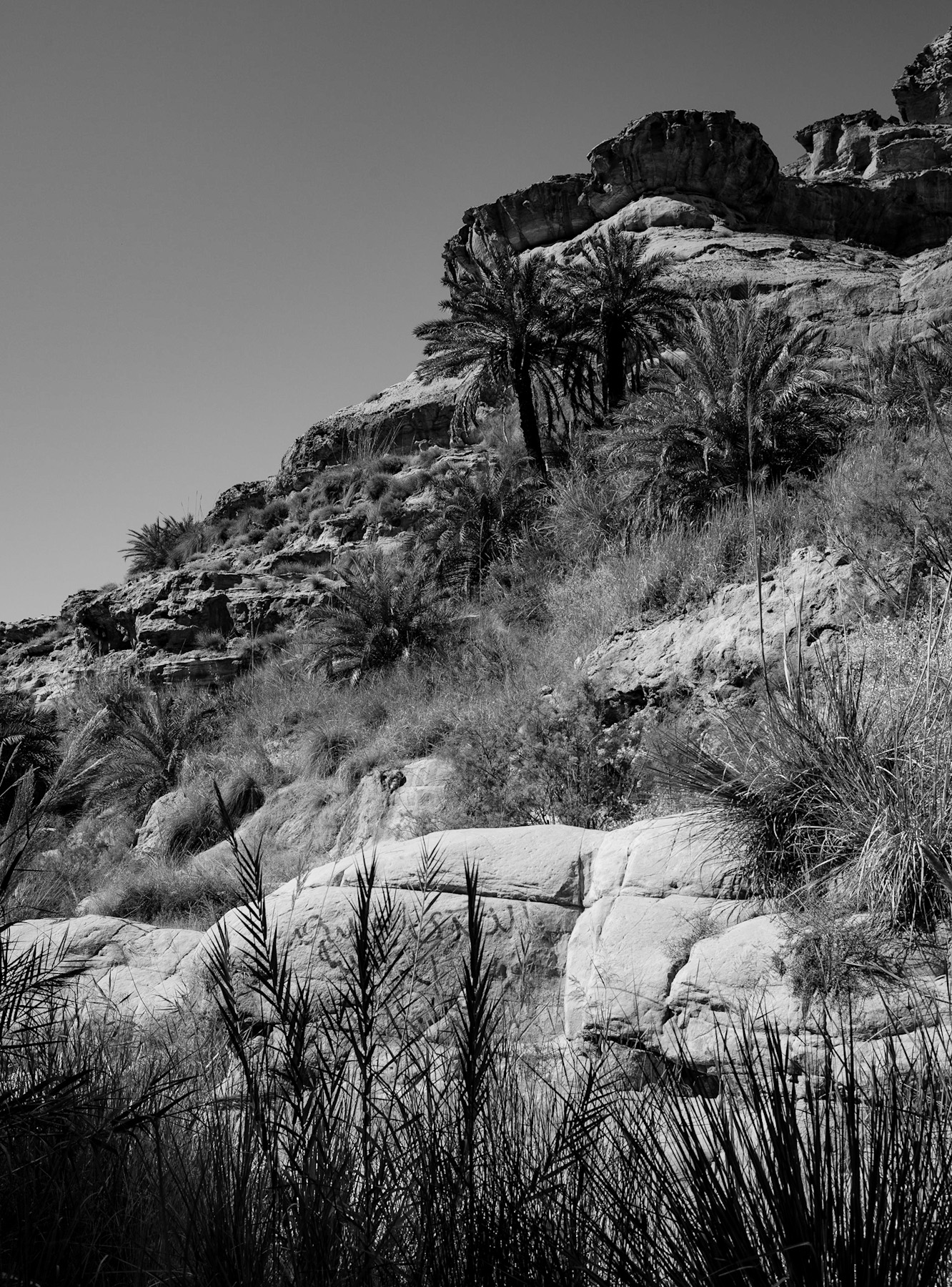
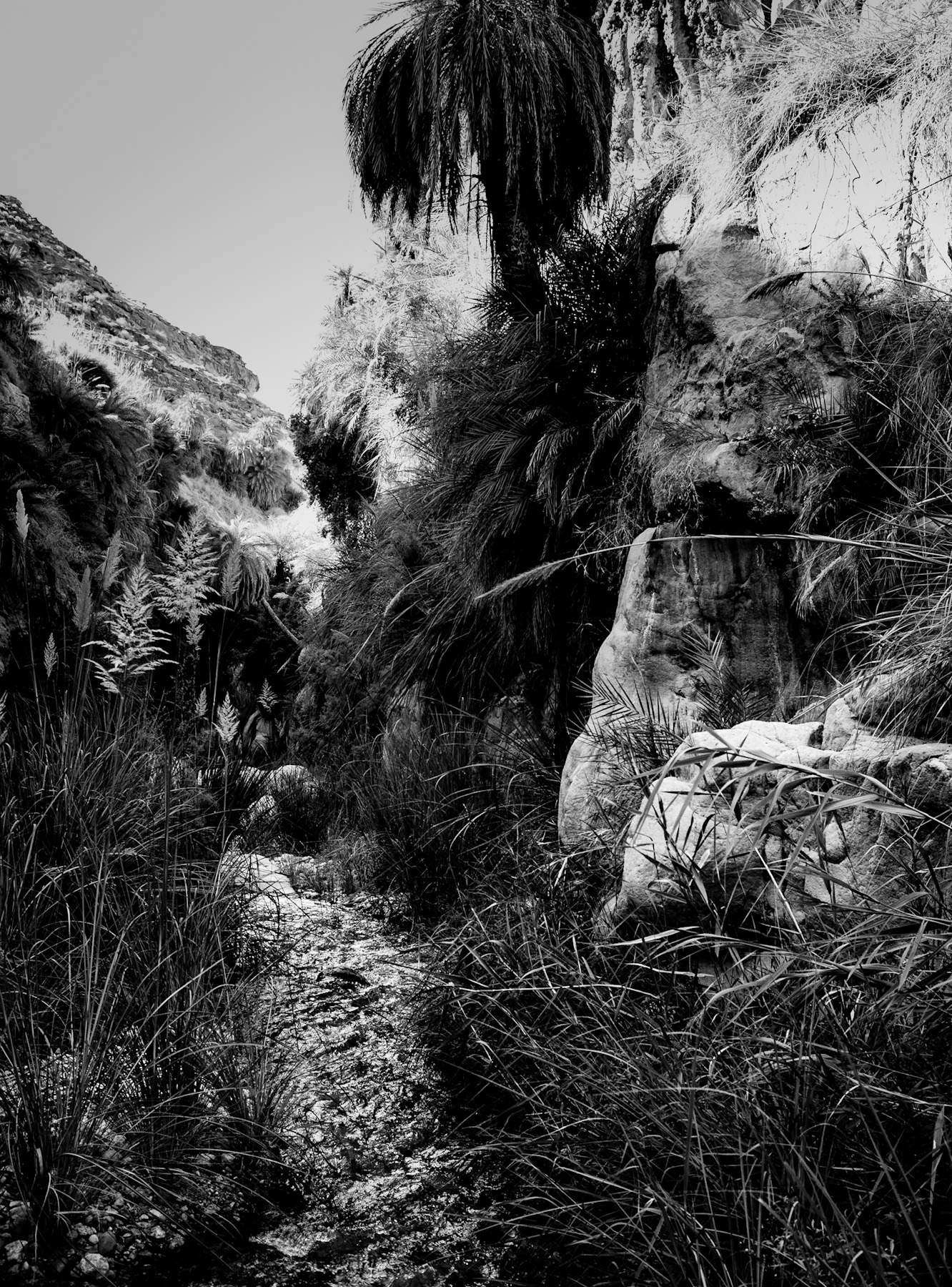
    In the foreground, a dense thicket of tall grasses and reeds commands attention. Their slender stalks and feathery seed heads create a dynamic, almost wild texture, catching the light and casting subtle shadows that emphasize depth. This lush vegetation speaks to the presence of water, hinting at a wadi – a dry riverbed that periodically fills with life-giving rain, or a hidden spring that nourishes this micro-environment. The resilience of these plants underscores the delicate balance of life in an otherwise harsh setting.
    Transitioning to the midground, the verdant expanse gives way to a cluster of palm trees, their fronds a darker silhouette against the brighter tones of the rock face. These palms further reinforce the notion of an oasis or a fertile pocket within the desert, a vital anchor for both flora and fauna. Beyond the immediate vegetation, the landscape ascends dramatically, revealing majestic rock formations. These colossal sandstone cliffs, characterized by their layered strata and weathered surfaces, bear the marks of millennia of erosion by wind and water. Their rugged contours and deep crevices evoke a sense of immense age and geological grandeur.
    Whispers of Civilizations Past
    This type of landscape, where water sources meet towering rock formations, has historically served as a cradle for human civilization and a critical waypoint for ancient trade. Regions across the Arabian Peninsula, such as AlUla or the broader landscapes associated with the Nabataeans, offer striking parallels. These environments were not merely obstacles but strategic arteries, facilitating the flow of goods, ideas, and cultures across vast distances.
    The very presence of wadis and oases dictated the routes of the ancient Incense Trade, connecting distant empires and supporting vibrant communities. Settlements often emerged at these vital water points, with inhabitants utilizing the natural protection of the cliffs and sometimes carving dwellings, tombs, and temples directly into the rock face. The layered appearance of the cliffs in the image could conceal such forgotten histories, echoing the architectural marvels found in places like Petra and Hegra, where human ingenuity transformed natural rock into enduring monuments. These sites stand as powerful reminders of human adaptation and the profound relationship between early societies and their challenging natural surroundings.
    Nature’s Resilience, Humanity’s Footprint
    The black and white rendition of this scene enhances its timeless quality, stripping away the distraction of color to focus on form, light, and texture. It emphasizes the enduring struggle and triumph of life in an arid environment and the silent witness of the ancient rocks to countless generations. The interplay between the vibrant, ephemeral reeds and the immutable, monumental cliffs encapsulates the dynamic relationship between fleeting life and geological permanence.
    Such landscapes continue to hold immense cultural and historical significance, inviting contemplation of the past and admiration for the natural world’s capacity for resilience. They are living museums, where every stone and every plant tells a part of a larger story – a narrative of ecological adaptation, ancient journeys, and the enduring human spirit that sought sustenance and meaning amidst the desert’s embrace.
  • Echoes in Stone: A Journey Through Ancient Landscapes

    Echoes in Stone: A Journey Through Ancient Landscapes

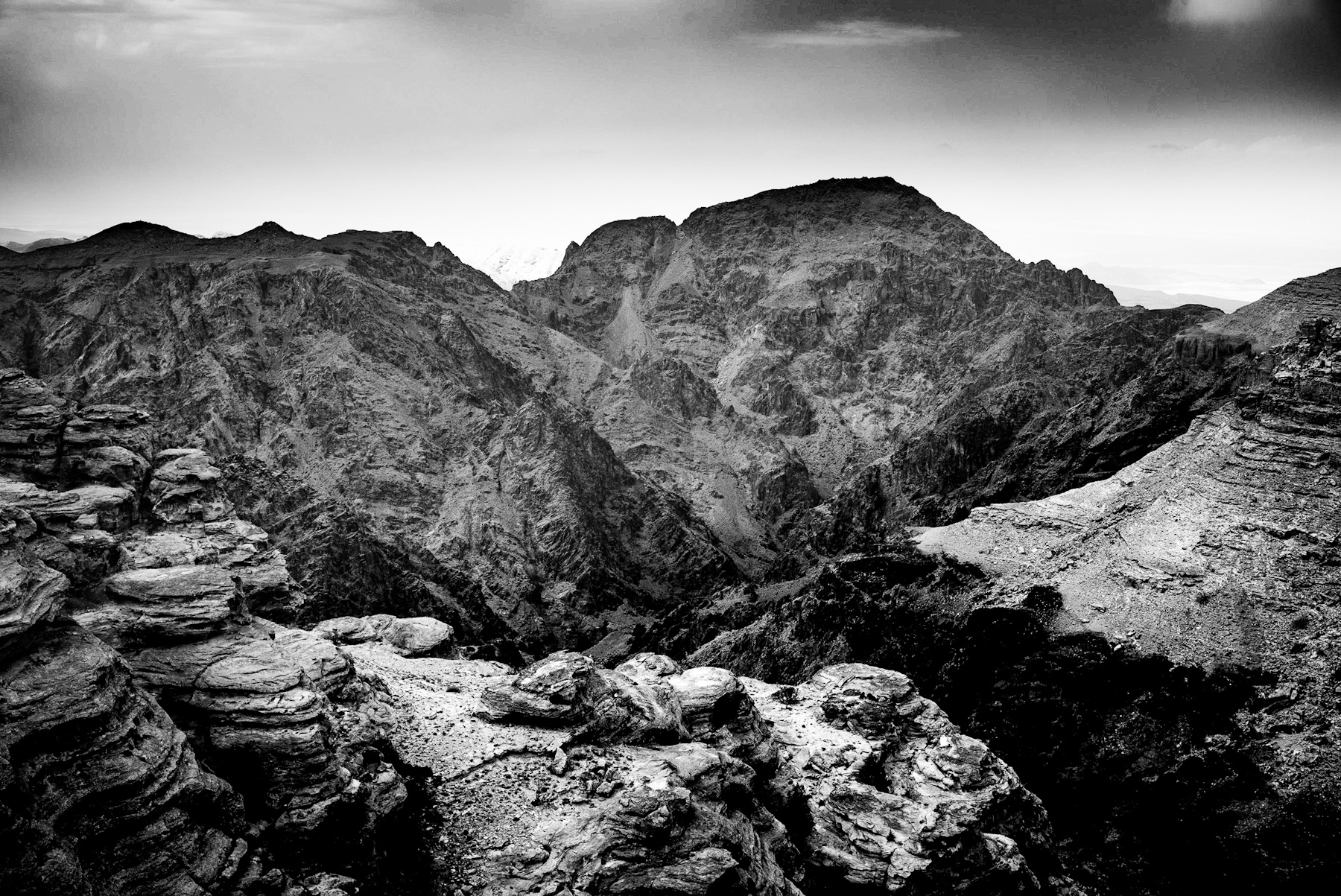
    The monochromatic lens captures a landscape of profound geological drama and historical resonance. This black and white photograph presents a rugged, arid environment dominated by massive, layered rock formations. The scene unfolds with a striking contrast, where deep shadows carve out the intricate textures of the sandstone cliffs, while brighter areas reveal the weathered surfaces of a vast, rocky plain stretching towards the horizon.
    Visualizing the Ancient Terrain
    In the foreground, a colossal rock face anchors the left side of the frame, its sheer bulk displaying millennia of erosion. Horizontal striations across its surface speak to layers of sediment deposited over geological epochs, each line telling a silent story of time. The rough, broken contours of the rock suggest a landscape shaped by powerful natural forces – wind, water, and seismic activity. Sparse, resilient vegetation clings to pockets within the rocks and scattered across the terrain, a testament to life’s persistence in harsh conditions.
    Mid-ground reveals a sprawling expanse of fractured rock and debris, a chaotic yet beautiful tapestry of nature’s raw power. Undulating hills and smaller rock outcrops punctuate this terrain, leading the eye deeper into the composition. The distant horizon is softened by a hazy sky, partially obscured by dramatic, brooding clouds that add a sense of weight and atmosphere to the scene. The absence of color intensifies the focus on form, texture, and the interplay of light and shadow, emphasizing the raw, untamed character of this ancient land.
    Historical Footprints in the Sandstone
    This landscape, with its distinctive sandstone formations and arid climate, strongly evokes regions like Petra in modern-day Jordan. Such geological settings were not merely backdrops but fundamental to the rise and endurance of ancient civilizations. The Nabataeans, an ancient Arab people, famously carved their magnificent city of Petra directly into similar sandstone cliffs. Flourishing from the 4th century BCE, Petra became a crucial hub for trade routes connecting Arabia with the Mediterranean, facilitating the exchange of spices, frankincense, and myrrh.
    The Nabataeans were master hydrologists, devising sophisticated systems to collect, store, and transport water across their desert kingdom, enabling agriculture and supporting a thriving population in an otherwise inhospitable environment. Their architectural genius is evident in the intricate facades of temples, tombs, and dwellings sculpted directly from the living rock, showcasing a unique blend of Hellenistic, Roman, and indigenous artistic styles. This photograph, while not depicting explicit archaeological structures, provides a visceral sense of the natural environment that cradled such a remarkable civilization. The very rocks depicted likely stood silent witness to the daily lives, trade, and cultural exchanges of the Nabataean people.
    An Enduring Legacy
    The visual narrative of this image extends beyond mere geological description. It invites contemplation on the deep connection between humanity and its environment. These ancient rock formations have endured countless cycles of erosion, yet they continue to stand, mirroring the resilience of the civilizations that once thrived within their embrace. The photograph serves as a powerful reminder of the historical layers embedded within our natural world, urging us to look beyond the surface and appreciate the profound stories etched into the very fabric of the earth. It is a testament to both nature’s grandeur and the enduring human spirit that adapted, innovated, and left its indelible mark on such formidable landscapes.
    Petra, Jordan, Nabataean, ancient civilizations, desert landscape, sandstone formations, historical sites, archaeological wonder, Middle East history, black and white photography, geological features, cultural heritage, arid environment.
  • Where Rock Meets History: Unveiling the Spirit of Ancient Petra

    Where Rock Meets History: Unveiling the Spirit of Ancient Petra

    The monochromatic intensity of this image immediately captivates, presenting a landscape where time seems to stand still. Dominant rock formations rise majestically, their surfaces etched with the millennia of wind and sand. Above, a turbulent sky, heavy with dark clouds, casts a dramatic shadow, enhancing the rugged contours of the terrain. This stark contrast between the luminous rock faces and the brooding heavens imbues the scene with a profound sense of ancient grandeur and untamed wilderness.
    A Tapestry of Stone and Sky
    The geological tapestry is rich with detail; layered sandstone cliffs showcase distinct stratifications, indicative of immense geological pressures and depositional history. Numerous small caves and eroded hollows pepper the rock faces, hinting at natural processes and perhaps early human interventions. Sparse, resilient desert flora dots the foreground, a testament to life’s persistence in arid conditions, their dark silhouettes adding depth to the composition. The interplay of light and shadow, expertly captured in black and white, accentuates every crevice and curve, transforming the landscape into a sculptural masterpiece. This dramatic visual narrative emphasizes the raw power and enduring beauty of Earth’s ancient formations.
    Echoes of an Ancient Civilization
    Beyond its striking natural beauty, this landscape resonates with a rich historical narrative, strongly reminiscent of the iconic ancient city of Petra in modern-day Jordan. The distinctive rock formations and the characteristic erosion patterns are hallmarks of this UNESCO World Heritage site, a place where nature and human ingenuity converged to create an unparalleled civilization. The very sandstone that forms these formidable cliffs was the medium for one of history’s most remarkable architectural achievements.
    The Legacy of the Nabataeans
    Petra, meaning ‚rock‘ in Greek, was the capital city of the Nabataeans, an ancient Arab people who settled here as early as the 4th century BC. Masters of hydraulic engineering and trade, they carved an entire city out of these very sandstone cliffs, transforming a seemingly inhospitable desert into a thriving metropolis. Their sophisticated water management systems allowed them to control vital trade routes, establishing Petra as a crucial hub connecting the East and West. The Nabataeans‘ architectural prowess is evident in the iconic facades of buildings like Al-Khazneh (The Treasury) and Ad Deir (The Monastery), though even the unadorned rock faces shown here speak volumes of the environment they mastered and revered. These monumental structures, hidden within a labyrinth of gorges and canyons, represent a peak of ancient civilization’s adaptability and artistic vision.
    Enduring Majesty and Historical Significance
    This photograph, therefore, is more than a mere depiction of natural beauty; it serves as a powerful reminder of an advanced civilization that thrived amidst challenging conditions. The enduring structures, both natural and man-made, stand as silent witnesses to millennia of human endeavor, cultural exchange, and artistic expression. The scene evokes the spirit of explorers, traders, and pilgrims who once traversed these very paths, leaving behind a legacy etched into the very fabric of the earth. The site’s historical layers, from Nabataean ingenuity to Roman influence and Byzantine presence, contribute to its archaeological wonder and global significance.
    In its raw, monochromatic splendor, the image invites contemplation on the deep interconnectedness between humanity and its environment. It underscores the profound stories held within ancient landscapes, urging us to appreciate both their intrinsic beauty and the historical echoes that continue to define them. This is a testament to nature’s enduring power and the indelible mark left by those who once called these majestic rocks home.
  • The Dead Sea Basin in Monochrome: A Timeless Testament to History and Nature

    The Dead Sea Basin in Monochrome: A Timeless Testament to History and Nature

    The stark, monochromatic landscape captured in this photograph evokes a profound sense of timelessness and raw beauty. Dominating the foreground is a sprawling, low-lying shrub, its intricate branches casting long, dramatic shadows across the arid, rocky terrain. This immediate visual anchors the viewer in a desolate yet captivating environment, hinting at stories etched deep within the earth.
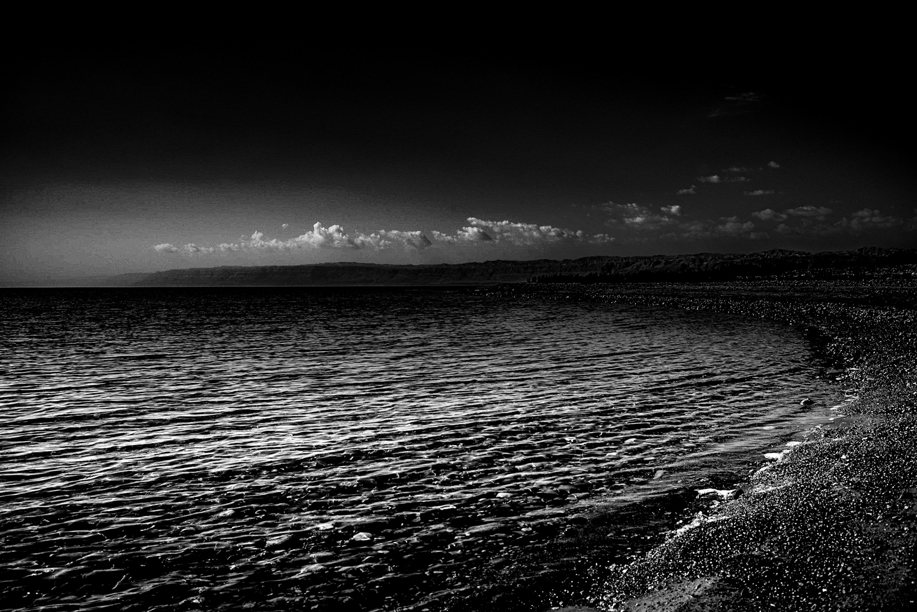
    Beyond the foreground vegetation, the eye is drawn to the serene expanse of a vast body of water, its surface reflecting the subtle light under a partly clouded sky. This expansive lake, appearing calm and almost ethereal in monochrome, is framed by rugged, ancient mountain ranges that stretch across the horizon. Their contours, softened by distance yet still commanding attention, speak of geological processes spanning eons. The minimalist palette of black, white, and myriad shades of grey accentuates the textural contrasts – the rough, gravelly ground, the smooth, reflective water, and the craggy, layered peaks. The scattered clouds across the dark, vast sky add a dynamic element, preventing the scene from being entirely static and hinting at the immense scale of the natural world. A discernible road or path subtly traces the water’s edge in the midground, a rare and understated human imprint on an otherwise wild and seemingly untouched expanse.
    This iconic vista is unmistakably that of the Dead Sea basin, a region steeped in millennia of human history and legend. Historically, this area has been a crucible of ancient civilizations and significant biblical events. The dramatic mountains in the background, likely the Judean Desert highlands or the mountains of Moab, have witnessed countless tales of prophets, kings, and empires. From the ancient settlements of Qumran, where the Dead Sea Scrolls were discovered, to the formidable fortress of Masada, a symbol of Jewish resistance against the Roman Empire, the very stones of this landscape resonate with echoes of the past. The biblical narratives of Sodom and Gomorrah are often associated with this unique geographical depression, further imbuing the area with a profound sense of historical and spiritual weight that continues to fascinate scholars and pilgrims alike.
    Beyond its rich historical narrative, the Dead Sea itself represents a marvel of natural history. As the lowest point on Earth, its hypersaline waters support a unique, albeit limited, ecosystem. The hardy vegetation visible in the foreground, likely a species adapted to extreme desert conditions, is a testament to the harsh realities of the surrounding environment. It demonstrates nature’s remarkable resilience in an area where fresh water is scarce and temperatures can be unforgiving. This interplay between barrenness and life, scarcity and survival, is a constant and compelling theme in the Dead Sea region, offering profound insights into ecological adaptation.
    The choice of black and white photography for this scene profoundly amplifies its timeless quality, stripping away the potential distractions of color to reveal the fundamental forms, textures, and stark realities of the land. It underscores the enduring nature of this unique landscape, which has remained largely unchanged for centuries, even as the ebb and flow of human history unfolded around its shores. Today, the Dead Sea faces significant environmental challenges, with its waters receding at an alarming rate due to human intervention and climate change. Yet, powerful photographs like this serve as a poignant reminder of its majestic beauty and profound historical significance, urging us to appreciate and actively preserve this irreplaceable natural and cultural treasure for future generations.
    Ultimately, this photograph is more than just a visual record; it is an invitation to contemplate the vast sweep of time, the resilience of nature, and the indelible marks left by human endeavor on one of the planet’s most extraordinary landscapes.